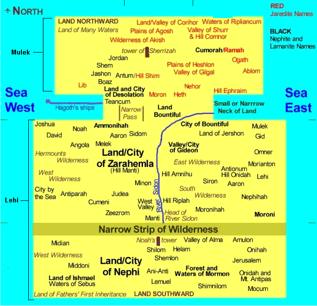
After several months of intense careful study of the text I have put together the following proposed map, showing the relative positions of Book of Mormon lands, cities, rivers, etc. See my answers to questions about the Book of Mormon HERE.
Notes about the map:
1. The Land of Zarahemla is at a lower elevation
relative to the Land of Nephi. When they speak of
going "down" to Zarahemla (Alma 56:25, Alma 53:12, Alma 27:5),
or "up" to Nephi (Mosiah 28:5, Alma 47:1) they are
probably talking about elevation rather than a
north/south direction.
2. The entire land was probably not surrounded by
water although North, South, East, and West seas are
mentioned.(Helaman 3: 8)
3. There were probably two cities named Aaron. One near Ammonihah (Alma 8: 13-14)), and one near Moroni (Alma 50: 14)
4. From the Valley of Alma to Zarahemla was a 12 day
journey on foot.(Mosiah 24: 20, 25)
5. From the West Sea to the East sea at the Narrow
Neck of Land was 1 to 1 1/2 days. (Alma 22: 32)
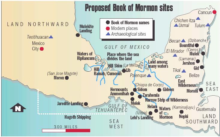
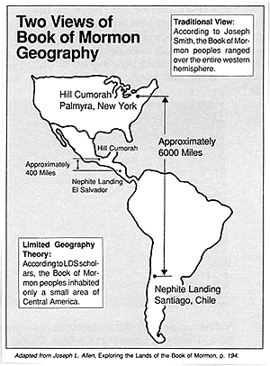
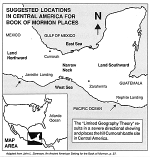
Following are two of the most well known theories for Book of Mormon geography:
An interesting correlation with Mesoamerican
geography(See map below):
Hill Ramah/Cumorah (Ether 15:11, Morm. 6:4) = Hill
Vigia, Mexico
Hill Shim (Morm 1:3) = Hill Cintepec, Mexico
Land of many waters/Ripliancum (Ether 15:8) = Waters
of Papalupan Basin, Mexico
Narrow neck of land where the sea divides the land
(Ether 10:20) = Gulf of Mexico